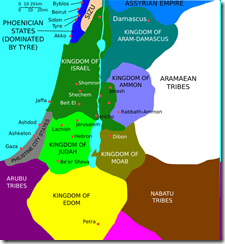
If you're a Biblical scholar, you'll recognize the map below from about 850 B.C. with the Kingdom of Moab clearly marked in what is today's country of Jordan. We did not travel to the historic Kingdom of Moab, We went to the American version in Utah. Which is the Kingdom of Bikes and Jeeps.
Both of us flew into Denver and drove about 7 hours to Moab. (Each of us had a person with a medical emergency on our flights to Denver. My plane had to land in Sioux Falls to take some poor sick guy off. I, personally, was sick of the delay that caused. But I didn't need a wheelchair to get off the plane. At least this time.)
We rented full suspension bikes so our bottoms would have a plush ride. In case it wasn't as plush as expected, though, I brought some "Butt Paste" to prevent the dreaded chafing. (Although it's safer to bike in a group, it's safer to apply the Butt Paste alone. Although, as Barb says, "Friends help friends." But brothers don't help brothers down there.) The first two mornings were chilly - 38 or so - with temps by late afternoon in the 60s. But sun, no wind and uphill biking keeps a person plenty warm. Then it warmed up to the 80s.
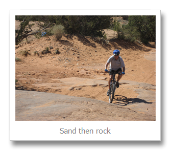
We rode "Klondike Bluffs" which is a beginner route - meaning it's unlikely you'll fall off a cliff. But it's likely you'll go through plenty of sand in dry washes and then ride uphill over bare slickrock. But in the slickrock, the BLM rangers have put cool dinosaur tracks. (Not really. These tracks are the real thing.) So you bike past dinosaur tracks, up and over lumpy rock, trying to pick the right line so you don't fall over and test your helmet's breaking strength. Also, trying to avoid the Jeepers and ATVers who're sharing the road rock.
As you can see from the above video, the rock is not smooth.
The next day, we hiked up a very steep and difficult trail called the "Portal Trail" which is on one side of the opening in the cliffs where the Colorado River runs.
At the top it looks like this:
We didn't bike this trail since most of it would require carrying our bikes. Plus, we didn't want to fall off a cliff - helmet testing has its limits.
We biked the "Poison Spider Mesa" trail next which is a well-known Jeep route. Very steep, rocky Jeep road at the start, then about 3/4 mile of sand, then steep bare rocks to the top. It's a good ride for firming and toning your thighs.
This truck is going down the rocks we rode up - and then down. On the uphill sections, the Jeeps were faster than us; downhill we were faster. (Remember, we had plush-bottom rides.)
There are two difficult sections of this trail, "The Waterfall" and "The Wedgie." Here's a 34 second video of Jeeping up "The Waterfall." There's a little bit of "French" at the end, so shield your ears. (I almost made it up the Waterfall on my bike; it was easier riding down.)
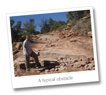
The next day, we had a brilliant idea, "Why not use a Jeep to go uphill instead of our legs?" So we rented a Jeep and drove about 25 miles north of town to a trail called "Top of the "World." This is an easy Jeep trail so it should be no problem for us. But I kept remembering what the Jeep rental guy said, "You broke it, you bought it." And there were tons of big, sharp rocks just desperate to break something on our vehicle. The roughest part of the ride was about 4 miles and it took us 1 hour each way - up and down. We had to be careful at ledges like this:
Several times I said, "Let's just stop." But Rolf told me to "Punch it. Get it up there." So we did and from the top, the view was worth it. We counted 7 different mountain ranges.
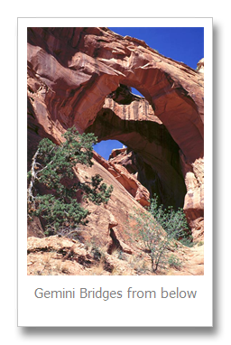
The last day we biked a trail called "Gemini Bridges." The first half was downhill on a Jeep road. Then a set of twin arches you could walk/bike over. Then lots of sand to a steep climb out.
This is what the arches look like from the bottom of where Rolf was standing in the photo above:


