Wednesday, October 28, 2009
Seven Summits
11/30/2009 7:00 PM
Please join us as extreme-endurance athlete, Troy Aupperle, shares his video and pictures from his recent summit of Mt. Everest on May 22nd and the completion of his quest for the "Seven Summits". His goal to set an American record was thwarted by logistic issues as well as international politics, but he persevered and still managed to complete it in the third fastest American time. Troy began his climbing career at REI, Inc. while managing the Climbing department at the Tempe store. He went through the beginning climbing course at AMC and met his eventual climbing mentor. Looking ahead to the next two years Troy will join the "Colorado Club" as he finishes the last of the 54 peaks over 14,000' as well as the High Pointers Club - climbing the highest point in each of the fifty states.
Location:REI Roseville
Contact:Customer Service 651-635-0211
Cost: Free
Monday, October 5, 2009
Monday, April 20, 2009
Thursday, April 2, 2009
Things to do around Moab
Here’s Moab from the sky. That’s the Colorado River running through it. You can see a lot of the bare “slickrock” sandstone. Which is the opposite of slick. It’s very frictiony.
From the Grand County web site, is this map. There are two ways to drive into town from I 70 when you’re coming from Denver. The most direct way and the most popular is to take Hwys 163/191 from Crescent Junction. If you have a little more time - like 30 more minutes – the most scenic way is to take Hwy 128 from I 70. It’ll knock your socks off. You drive along the Colorado River for about 30 miles past cliffs and towers.

Towers that are famous for rock climbing such as the Fisher Towers shown above and Castleton Tower shown below.
Castleton Tower is called one of “The 50 Classic Climbs of North America.”
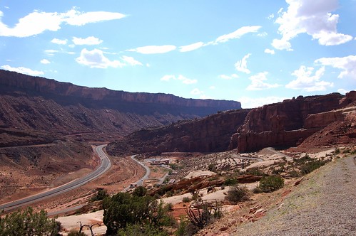
If you drive the faster, shorter route you will see views like this:

It’s not as awe-inspiring. And there’s no river until you get into town.
So big deal, you’ve arrived. Now what?
Here’s a climbing area that’s got a lot of bolted routes just outside of town and right alongside the Colorado River. You can belay from the car.
Let’s say you wanted to see Anasazi Indian pictographs and/or wooden ladders they used to get to the top of the cliffs. Well, on the other side of the River from the shot above, is this:
You can see the pictographs and the logs jammed into the rock chimney. (Of course, this is about 10 feet from the road. So be careful of not getting over heated.)
But let’s say you wanted to bike. OK, here are some trails I’d recommend; in this order unless your buddies are feeling pretty confident on their bikes. I’m assuming you only have one car and that you can get your bikes in the car. There are many more options if you hire a shuttle or you have two cars.
- Klondike Bluffs – this is fairly short (3-4 hours) and technically easy trip where you can see dinosaur tracks, mine ruins and a great view of Arches National Park as well as 4 different mountain ranges. (This requires a drive out of town about 8 miles.)
- Slickrock Trail – you can ride up to the this trail from downtown Moab or save some energy - ‘cuz it’s all uphill – and drive about 5 minutes to the start. You can ride for 10 minutes on this trail or 2-4 hours. It’s almost all on just plain bare rock. Except for where there are sand pits. Lots of steep, short climbs. If you can push the pedals down, you can climb all the hills.
- Poison Spider Mesa – this is a long bike ride of about 4-5 hours. It’s fairly technical and gets you up to great vistas overlooking the River.
- Porcupine Rim – this is an all day ride and will require a shuttle or a 2nd car. It has lots of climbing to a grand view of Castle Valley – see above – and a very fast and long descent that puts you right alongside the Colorado River. Technical in many areas.


